"Życie to krótki sen, którego sentymentalnie ja się nie wstydzę..." //z piosenki Stanisława Sojki//
Start
Cycle routes
Photos
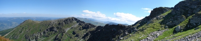
Bieszczady mountains have been already described in the hiking section, but I think that
I should also draw Your attention to bicycle trips aroung Bieszczady and the neighbourhood.
The area of Bieszczady is low industrialized (of course beyond Bieszczady National Park, where
as it used to be in national parks is totally wild without any civilization ), what implicates low traffic.
Described routes lead asphalt roads, the best bike type on such roads is so called road bicycle (or cross bicycle ).
I'd suggest to bring bike by train or just ride to Bieszczady by bike. You should know that majority of trains reaches
Zagórz or Przemyśl, and farther road You have to ride yourselfs. Cycling in Bieszczady ( I mean asphalt roads of course )
technically is not very difficult, but requires good physical condition. Difficulties can be caused especially by riding up the passes,
although effort is compensated by fantastic downhill (from the pass)...
 You should remember, that in case of problems with the bicycle, You are left on Your own
( small bicycle shops are in Ustrzyki Dolne and Lesko). Therefore it is necessarily to have with Yourself basic repair set like:
small patches and glue, small pump, spare tube, grease to the bikechain, the set of screwdrivers (in Poland so-called - imbus)
and also the torch (small gloves and some rag are also useful in practice).
You should remember, that in case of problems with the bicycle, You are left on Your own
( small bicycle shops are in Ustrzyki Dolne and Lesko). Therefore it is necessarily to have with Yourself basic repair set like:
small patches and glue, small pump, spare tube, grease to the bikechain, the set of screwdrivers (in Poland so-called - imbus)
and also the torch (small gloves and some rag are also useful in practice).
Suggested cycle routes (routes lenght can differ +/-5 km from the reality):
1. South-eastern part of the Bieszczady mountains - to the grave of Klara Stroińska countess and Franciszek Stroinski count, San river spring, the border with Ukraine, viewpoint to the Sianki
Berehy Górne (0 km) - Dwernik (10 km) - Dwerniczek (14 km) - Stuposiany (17 km) - Muczne (26 km) - Tarnawa Niżna (31 km) - shelter BPN Negrylowy (45 km) (here we have to leave our bike, because further cycle is forbidden and You have to go by walk) - the grave of Klara and Franciszek Stroiński - viewpoint to the Sianki (if You'll have enough time, You can go to see San river spring, it's about half of hour from view point) - coming back to shelter BPN Negrylowy - Tarnawa Niżna (59 km) - Muczne (64 km) - Stuposiany (73 km) - Ustrzyki Górne (84 km) - Berehy Górne (92 km)
route length - about 90 km, plus approx 3.5 hours hiking
Show Bieszczady South - East part on bigger map
The described route is relatively difficult, first of all due to
large distance that must be covered.
You should be prepared for approx 14 hours,
but in the summer, when the day is long, it is no such a big problem.
The trip begins in Berehy Górne and You have to choose the Nasiczne
village direction and further Dwernik.
The road is in good quality (in 2008 there was made new asphalt).
Up to Dwernik, along the route there, flows a stream, which successively changing names:
Prowcza, Nasiczański, Dwernik (flows into the San).
In Dwernik You have to turn right in the Dwerniczek direction.
After 4 km we reach the main road.
You have to turn right in the Stuposiany direction.
After reaching Stuposiany village, we turn left in Muczne direction.
 Immediately after the turn, we have sharp but short route up.
Further way to Muczne and continue to Tarnawa does not make difficulties,
however, asphalt is in bad condition (as of 2008).
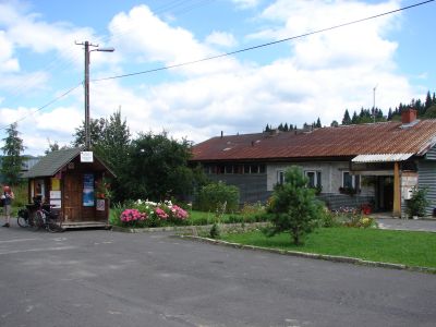
In Muczne are a few holiday houses, a shop (you can
break for short rest, fast food and drink something cool).
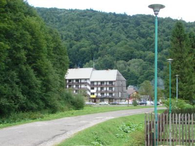
There is also hotel which was the center for the Minister Cabinet
(in the years 1975 to 1981 this area was closed to tourists
and intended for PRL (Polish People's Republic) officials and
so-called foreign dignitary).
From Muczne to Tarnawa Niżna we have approx 5 km ride.
Tarnawa Niżna is a part of currently non-existent Tarnawa village on the San river.
Nowadays on this place there is postwar settlement, with
tourist centre BPN (Bieszczady National Park) hostel, camping, horse-riding.
Immediately after the turn, we have sharp but short route up.
Further way to Muczne and continue to Tarnawa does not make difficulties,
however, asphalt is in bad condition (as of 2008).
In Muczne are a few holiday houses, a shop (you can
break for short rest, fast food and drink something cool).
There is also hotel which was the center for the Minister Cabinet
(in the years 1975 to 1981 this area was closed to tourists
and intended for PRL (Polish People's Republic) officials and
so-called foreign dignitary).
From Muczne to Tarnawa Niżna we have approx 5 km ride.
Tarnawa Niżna is a part of currently non-existent Tarnawa village on the San river.
Nowadays on this place there is postwar settlement, with
tourist centre BPN (Bieszczady National Park) hostel, camping, horse-riding.
 In Tarnawa Niżna public road ends and starts Bieszczady National Park
(here is cash point, You have to pay for an entry about 1 Eur).
Further, for about 6 km we ride hilly asphalt road.
The hills are so "constructed", that using the strength of the downhill ride of one
we will reach the next without effort.
The next part of our trip leads by non-asphalt road through unfortunately, currently
non-existent villages: Bukowiec (in Bukowiec You have to keep to the left side
and follow blue marks), Beniowa
In Tarnawa Niżna public road ends and starts Bieszczady National Park
(here is cash point, You have to pay for an entry about 1 Eur).
Further, for about 6 km we ride hilly asphalt road.
The hills are so "constructed", that using the strength of the downhill ride of one
we will reach the next without effort.
The next part of our trip leads by non-asphalt road through unfortunately, currently
non-existent villages: Bukowiec (in Bukowiec You have to keep to the left side
and follow blue marks), Beniowa
 up to the shelter Negrylowy.
Here, I don't understand why, because road leads further, riding a bike is forbidden.
So You have to leave the bike somewhere, just in case it's better to padlock it.
To the tomb of Countess Clara (nee Kalinowska) and Count
Frańciszek Stroiński leads the blue marked route and takes about 1.10 hour.
Next, we have 20 min. hiking to the view point on the Ukrainian side Sianki -
Wierszek hill (871 m), and a further 20 min. the spring of the San river.
We're coming back the same route, You can reduce it a little bit -
from Negrylowy where we left our bikes, we return ignoring Beniowa.
up to the shelter Negrylowy.
Here, I don't understand why, because road leads further, riding a bike is forbidden.
So You have to leave the bike somewhere, just in case it's better to padlock it.
To the tomb of Countess Clara (nee Kalinowska) and Count
Frańciszek Stroiński leads the blue marked route and takes about 1.10 hour.
Next, we have 20 min. hiking to the view point on the Ukrainian side Sianki -
Wierszek hill (871 m), and a further 20 min. the spring of the San river.
We're coming back the same route, You can reduce it a little bit -
from Negrylowy where we left our bikes, we return ignoring Beniowa.
2. "Small Bieszczadys' loop"
Berehy Górne (0 km) - Dwernik (10 km) - Chmiel (13 km) - Sękowiec (17 km) - wzdłuż Sanu (29 km) - Rajskie (32 km) - Bukowiec (38 km) - Terka (40 km) - Polanki (43 km) - Buk (48 km) - Dołżyca (52 km) - Przysłup (57 km) - Kalnica (61 km) - Smerek (64 km) - Wetlina (68 km) - Berehy Górne (76 km)
route lenght - approx. 80 km
Show Small Bieszczady loop on the bigger map
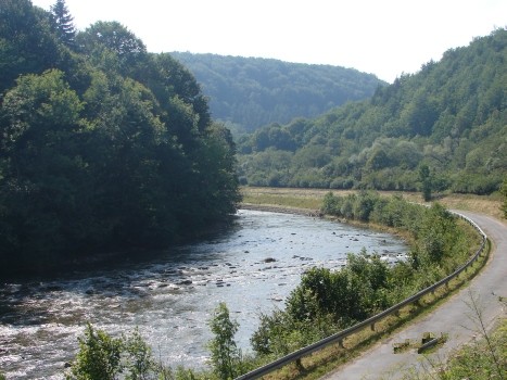
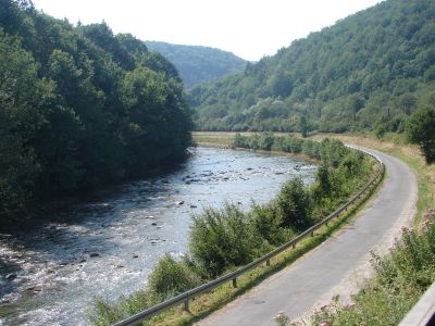
The proposed route is very charming, especially at section leading along the San riverside (from Sękowiec).
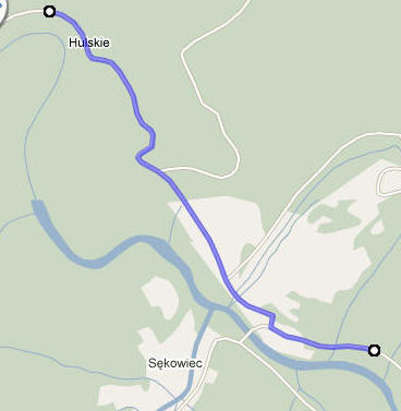
Our route starts from Berehy Górne - to Dwernik - just like in the description of Route No. 1 (above). In Dwernik You have to turn left. We cycle through Chmiel (here we see orthodox church rescued from communist era) to Sękowiec, where we ride straight, but the path is a bit twisting, so I sketched this part of route (using google maps).
Our path runs partly along the edge of the forest, partly along the coastal scrub.
Lack of popular hiking trails makes that this area has its specific atmosphere.
Passed places like Chmiel, Sękowiec are non-commercial villages.
 The route sometimes is very close to the river shore and sometimes further.
The river shore is either covered with boulders or densely covered by vegetation
(e.g. nettle), so it is rather not good for sunbathing.
It is also difficult to get into the water to bathe.
You can bathe after reaching bridge on San river (there is very
shallow and sharp rocky bottom, so if You want to bathe it would be good to have a
flip-flops).
The route sometimes is very close to the river shore and sometimes further.
The river shore is either covered with boulders or densely covered by vegetation
(e.g. nettle), so it is rather not good for sunbathing.
It is also difficult to get into the water to bathe.
You can bathe after reaching bridge on San river (there is very
shallow and sharp rocky bottom, so if You want to bathe it would be good to have a
flip-flops).
 After crossing the bridge we turn right and through Rajskie village (about 3 km)
we reaching main road, where You have to turn left.
We cycle about 6 km and after at the beginning of Bukowiec village
we turn right in the direction of Terka.
Right after the turn is very short, but extremely steep uphill.
After crossing the bridge we turn right and through Rajskie village (about 3 km)
we reaching main road, where You have to turn left.
We cycle about 6 km and after at the beginning of Bukowiec village
we turn right in the direction of Terka.
Right after the turn is very short, but extremely steep uphill.
 From Terka we ride to Dołżyca using a part of marked cycle route
"R61 Greenway Eastern Carpathians "- about 14 km, a large part of the route
is downhill ride).
In Dołżyca (here you can relax in a restaurant placed on the left side of the road)
after reaching the main road, You have to turn left on Wetlina village direction.
Unfortunately, pleasure of downhill ride costs us the uphill ride to the Przysłop pass.
Then there is Kalnica uphill and approximately 6 km (from Kalnica) to Wetlina.
In Wetlina You can have a rest. There are some restaurants where You can eat and drink.
By the end of the route, means to Berehy is 8 km (including arduous
uphill ride to Wyżna pass and after downhill ride to Berehy with wonderful views).
From Terka we ride to Dołżyca using a part of marked cycle route
"R61 Greenway Eastern Carpathians "- about 14 km, a large part of the route
is downhill ride).
In Dołżyca (here you can relax in a restaurant placed on the left side of the road)
after reaching the main road, You have to turn left on Wetlina village direction.
Unfortunately, pleasure of downhill ride costs us the uphill ride to the Przysłop pass.
Then there is Kalnica uphill and approximately 6 km (from Kalnica) to Wetlina.
In Wetlina You can have a rest. There are some restaurants where You can eat and drink.
By the end of the route, means to Berehy is 8 km (including arduous
uphill ride to Wyżna pass and after downhill ride to Berehy with wonderful views).
3a. From Zagórz to Nowy Łupków
Zagórz (0 km) - Poraż (8 km) - Morochów (11 km) - Wysoczany (19 km) - Szczawne (22 km) - Rzepedź (29 km) - Komańcza (35 km) - Nowy Łupków (46 km)
route lenght - 46 km
Show Route 3a Zagórz - Nowy Łupków on the bigger map
Routes 3a and 3b are suggested especially for those tourists
who don't have car and want to bring bikes to Bieszczdy by train.
In summer time You can take Your bike into the train
from many places in Poland and come to the train station Zagórz.
The route is quite easy.
 The biggest attraction is that mainly this route runs along the rivers: Osławica
and Osława and railways.
In 2008 we traveled this route in one direction by train and
came back on bikes.
Unfortunately, we lost some pictures from this trip and the only photos we have
are from train.
In Nowy Łupków You can stay for night in PTSM - it is reccomended to call before
(new Slate - PTSM Hostel, Tel: (013) 462-52-11 w.43).
I would also recommended for evening bar in Nowy Łupków behind
the train station, with very nice service and interesting guests.
Unfortunately, there is no longer available to carry bike by train
to Miedzylaborce - Slovakia).
The biggest attraction is that mainly this route runs along the rivers: Osławica
and Osława and railways.
In 2008 we traveled this route in one direction by train and
came back on bikes.
Unfortunately, we lost some pictures from this trip and the only photos we have
are from train.
In Nowy Łupków You can stay for night in PTSM - it is reccomended to call before
(new Slate - PTSM Hostel, Tel: (013) 462-52-11 w.43).
I would also recommended for evening bar in Nowy Łupków behind
the train station, with very nice service and interesting guests.
Unfortunately, there is no longer available to carry bike by train
to Miedzylaborce - Slovakia).
3b. From Nowy Łupków to Berehy
Nowy Łupków (0 km) - Wola Michowa (7 km) - Żubracze (17 km) - Cisna (22 km) - Kalnica (34 km) - Wetlina (41 km) - Berehy (49 km)
route lenght - about 50 km
Show Route 3b - Nowy Łupków - Berehy Górne on the bigger map
This route is a bit more difficult than the previous one, because we have
several uphill rides.
Again, as in case of route 3a, I do not describe the exact route
because we cycle the main road (there is not a big traffic on it).
 3 km after the Żubracze village there is main station of former
Bieszczady train - called Majdan. It is really worth to see.
In Cisna (a small town) You can have a rest. Numerous restourants
offer food and drink. I recommend a restaurant Zacisze - placed
close to the main road on the right side. It offers a delicious lunch
at reasonable prices.
3 km after the Żubracze village there is main station of former
Bieszczady train - called Majdan. It is really worth to see.
In Cisna (a small town) You can have a rest. Numerous restourants
offer food and drink. I recommend a restaurant Zacisze - placed
close to the main road on the right side. It offers a delicious lunch
at reasonable prices.

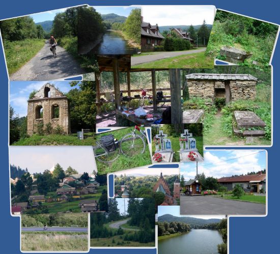
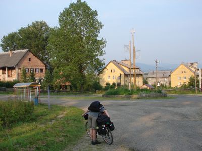
Photogallery of Bieszczady cycle
(click on below photos to go to galleries)
Photogallery of Bieszczady cycle - part 1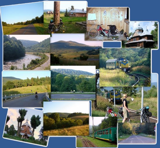
Photogallery of Bieszczady cycle - part 2